|
|
Cutthroat Trout Management | Concepts | Cutthroat Trout Management |
|
DIMENSIONS:
|
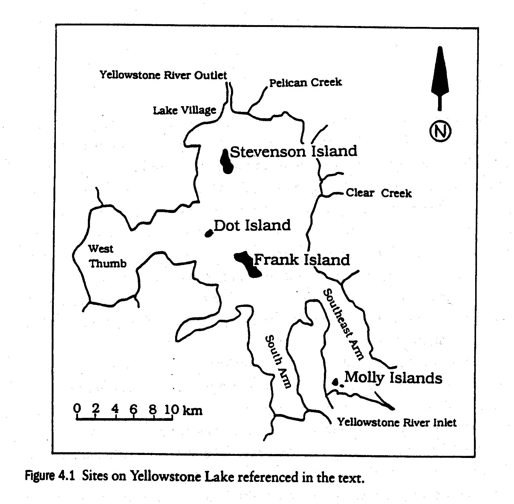
MapsThese maps are here to provide a sense of spatial scale and to help relay information on distributions of aquatic species in Yellowstone National Park.
Important features to point out from map are: 1). The West Thumb is an area of Lake Trout breeding and intense management by the NPS. 2). Molly Islands are an important breeding ground for white pelicans. The Islands have a protected buffer around them in which no motor boats are allowed.
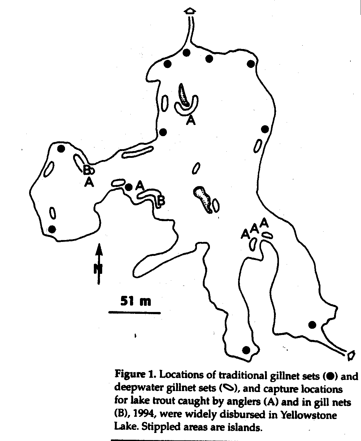
Important features to observe from this map are: 1). The open ovals are places where the NPS have tried setting deepwater gillnets to catch lake trout. 2). Lake trout caught, represented by As and Bs, are dispersed randomly throughout the lake. This shows the nomadic nature of the lake trout and how far spread the species impact can be felt in the lake. 3). This graph is from 1994 and many more lake trout have since been caught.
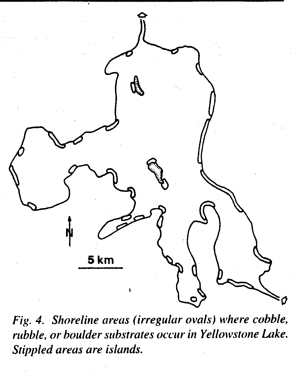
Cobble, rubble, and boulder substrates on lake sides is important for lake trout reproduction. This map shows that many kilometers of Yellowstone Lakes shore is suitable breeding habitat for lake trout.
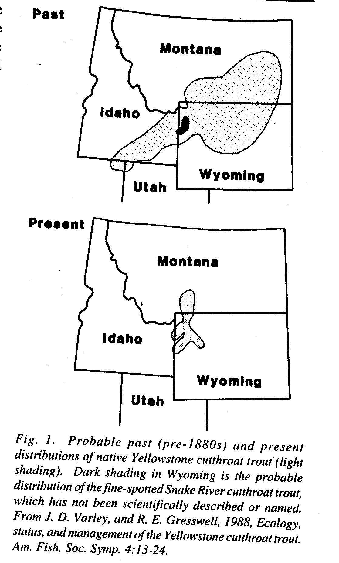
The native range of Yellowstone cutthroat trout has been reduced dramatically. The home range has reduced due to species introductions, loss of habitat, and hybridization with other cutthroat and rainbow trouts.
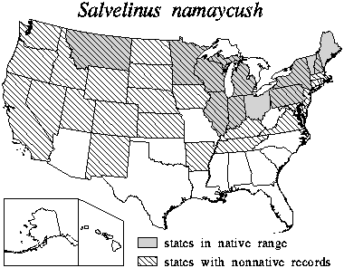
This map is important to show how introductions by man have spread the lake trout home range well beyond its native range.
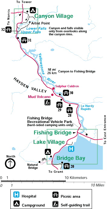
Fishing Bridge and Le Hardy Rapids are important areas for fish viewing tourism. This section of Yellowstone River was closed to fishing to help the recovery of the cutthroat trout.
|